Naliya Fm
Type Locality and Naming
SUBSURFACE. (Local). Interval 2445-2840m in well GK-23-1. [Original Publication: Zutshi, P.L., Mittal, S.K and Shah, L. (1993) Lithostratigraphy of Indian Petroliferous Basins, Document IV, Kutch Saurashtra Basin, KDMIPE, ONGC Publication, pp 1-50.]
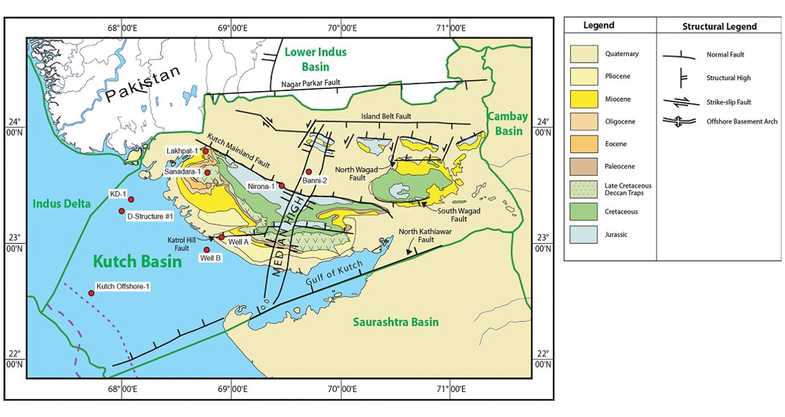
[Fig. Geological and structural map of Kutch, also showing the onshore and offshore wells drilled for oil exploration. (Map by Rasoul Sorkhabi in GeoExpro Dec2014, based on various sources including S.K. Biswas, Current Science, 25May2005)]
Lithology and Thickness
Claystone and marl. Mainly claystone and marl/limestone along with minor calcareous sandstone and shale. Claystone is fossiliferous, occasionally carbonaceous pyretic, minor limestone and coal. 395 m in well GK-23-1.
Relationships and Distribution
Lower contact
With Bhuj Fm is marked by break in resistivity and gamma rays logs.
Upper contact
Unconformable with Deccan Traps Fm, easily distinguish by based upon logs.
Regional extent
GeoJSON
Fossils
Dicarinella concavata, Marginotruncana pseudolinneiana, Rostia fornicata
Age
Depositional setting
Middle outer shelf
Additional Information
